Powerful 7.6-Magnitude Quake Triggers Tsunami Alerts in Southern Philippines
A powerful 7.6-magnitude offshore earthquake struck off the southern Philippines on Friday morning, prompting urgent evacuations from coastal areas amid warnings of potentially destructive tsunami waves.
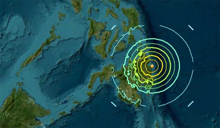
The Philippine Institute of Volcanology and Seismology (Phivolcs) said the quake was centered about 62 kilometers southeast of Manay town in Davao Oriental province, at a shallow depth of 10 kilometers. Authorities warned of possible damage and aftershocks.
“Destructive tsunami is expected with life-threatening wave heights,” Phivolcs said, urging residents along the country’s eastern coast to “immediately evacuate to higher ground or move farther inland.”
The Pacific Tsunami Warning Center (PTWC) in Honolulu said hazardous waves were possible within 300 kilometers of the epicenter, with some Philippine coasts potentially facing surges of up to 3 meters (10 feet). Smaller waves could also reach Indonesia and Palau, the center added.
Office of Civil Defense deputy administrator Bernardo Rafaelito Alejandro IV said tsunami waves could hit six coastal provinces within two hours of the quake, which struck at 9:43 a.m. “We urge these coastal communities to be on alert and immediately evacuate to higher grounds until further notice,” he said in a televised briefing.
He also advised boat owners to secure their vessels and move away from waterfronts.
Davao Oriental Governor Edwin Jubahib reported panic among residents as strong tremors rocked the province. “Some buildings were reported to have been damaged,” he told local broadcaster DZMM.
Neighboring Indonesia also issued a tsunami warning for northeastern regions of Papua and North Sulawesi, about 275 kilometers from the epicenter, advising residents to stay away from beaches and riverbanks.
The PTWC reiterated that waves of 1 to 3 meters above tide level were possible along the Philippine coast, with smaller waves expected in nearby countries.
The quake comes just two weeks after the Philippines’ deadliest earthquake in over a decade, a 6.9-magnitude tremor that killed 72 people on Cebu island.
Located along the Pacific “Ring of Fire,” the Philippines experiences frequent seismic activity, with more than 800 earthquakes recorded annually. The European-Mediterranean Seismological Center estimated Friday’s quake at magnitude 7.4 and a depth of 58 kilometers (36 miles).
Comments are closed.