Cyclone ‘Ditwah’ Forms After Rare Storm Senyar, May Hit Tamil Nadu Coast Soon: IMD
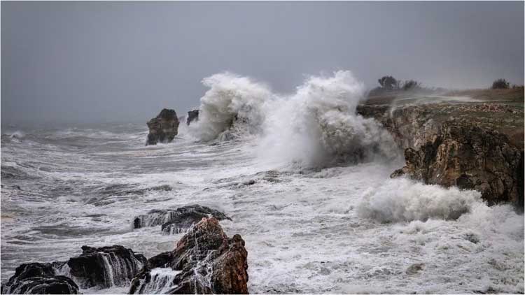
As Cyclone Senyar—the rare weather system that intensified in the Strait of Malacca—moved away from India’s coast, another system over the southwest Bay of Bengal strengthened into a cyclonic storm, Ditwah, with its impact expected over Tamil Nadu, Puducherry and adjoining south Andhra Pradesh by November 30, the India Meteorological Department (IMD) said.
In an early Thursday update, the IMD said Cyclone Senyar was located about 850 km southeast of Car Nicobar and was likely to weaken into a depression by evening. At the same time, a parallel low-pressure system brewing over the southwest Bay of Bengal, the southeast Sri Lankan region and the Equatorial Indian Ocean continued to intensify.
Cyclone Ditwah Forms
In its latest post on X, the IMD confirmed that Cyclone Ditwah had formed over the southwest Bay of Bengal near Pottuvil—around 700 km south-southeast of Chennai. The storm is expected to move north-northwest and approach the north Tamil Nadu–Puducherry–south Andhra Pradesh coasts by early November 30.
The name Ditwah was submitted by Yemen as part of the north Indian Ocean cyclone naming roster.
“Cyclone Ditwah formed over the SW Bay of Bengal near 6.9°N/81.9°E at 1130 IST today. It lay close to Pottuvil, ~90 km SSE of Batticaloa and ~700 km SSE of Chennai. The system will move NNW and reach off North Tamil Nadu–Puducherry–south AP coasts by early 30 Nov,” the IMD said in its 2:56 p.m. update.
Several districts in Tamil Nadu, including Chennai, Nagapattinam, Thiruvallur and Thanjavur, are under yellow and orange alerts for November 27–29.
The ‘Rare’ Cyclone Senyar
Cyclone Senyar formed in the Strait of Malacca—a narrow channel between Peninsular Malaysia and Indonesia’s Sumatra island, with Singapore at its southeastern tip. The strait opens into the Andaman Sea at its northwestern end.
The storm moved away from Indian territory and headed toward Malaysia, nearing the coast of Sumatra, Malaysian news outlet NST reported, citing MetMalaysia director-general Mohd Hisham Mohd Anip.
Meteorologists have labelled Senyar “rare,” with experts noting it is the first system of cyclonic-storm intensity ever recorded in the Strait of Malacca.
“The last one, a tropical depression, occurred in 2017 and affected Penang. But for a system to reach tropical storm intensity, as we are now seeing near Sumatra, this is a first,” Hisham said.
MetMalaysia issued a tropical storm alert as the system was tracked at 4.5°N and 97.9°E, moving west-southwest at 9 km/h with sustained winds of 83 km/h—its closest point to Malaysia being about 284 km southwest of George Town, Penang.
The agency warned of heavy rain, strong winds and rough seas across several northern states. The storm is now expected to batter northern Sumatra with intense rainfall and potential flooding.
Weather watchers online have also described Senyar as “rarest of rare.”
One X user, @chennaisweather, wrote: “Even if short-lived, this cyclone remains one of the rarest ever recorded near the Malacca Strait, making this a historic meteorological event.”
Another user noted that, based on the US Joint Typhoon Warning Center’s latest forecast, Senyar “could become the first tropical cyclone in recorded history to make landfall on the western coast of Peninsular Malaysia—after Typhoon Vamei in 2001.”
Comments are closed.