Cold wave eases after five days as Delhi records minimum of 4.3°C
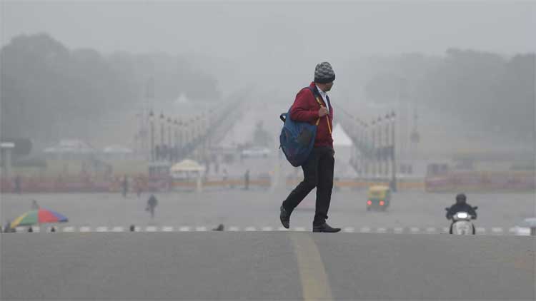
Cold wave conditions in Delhi eased on Friday after five days as the city’s representative weather station at Safdarjung recorded a minimum temperature of 4.3°C, up from 2.9°C on Thursday. However, a yellow alert remained in place, with moderate to dense fog enveloping parts of the city in the early hours, while air quality continued to be “very poor”.
The minimum temperature on Friday was 3.3°C below normal. A day earlier, Delhi had recorded its coldest night since January 18, 2023, when the temperature dropped to 2.6°C.
At Palam, the minimum temperature rose to 4.7°C from 2.3°C on Thursday, remaining 2.8°C below normal. The airport station had recorded its lowest minimum in 20 years on Thursday, when the mercury plunged to 0.3°C on January 8, 2006. Other stations reported minimum temperatures of 4.7°C at Lodhi Road, 6°C at Ridge and 4.3°C at Ayanagar. None of the major weather stations recorded cold wave conditions on Friday.
A cold wave is declared when the minimum temperature is below 10°C and at least 4.5°C below normal, or when it falls to 4°C or lower. The minimum temperature is expected to rise further over the weekend, with no cold wave conditions likely in the coming days. Forecasts suggest minimum temperatures of 6–8°C by Sunday and 7–9°C by Monday.
Air quality, however, remained a concern. The Air Quality Index (AQI) stood at 350 — in the “very poor” category — at 9 am on Friday, compared with a 24-hour average of 343 recorded at 4 pm on Thursday. According to the Air Quality Early Warning System (AQEWS), air quality is expected to stay “very poor” until Saturday before deteriorating to the “severe” category on Sunday.
“The outlook for the subsequent six days is that the air quality is likely to be in the severe to very poor category,” AQEWS said.
Comments are closed.